
 Facebook
 Twitter
 Pinterest
 Copy Link
Hiking season is just around the corner! While Park City will be muddy in spring, heading to Salt Lake City will yield your first hikes of spring! Consider making the half hour trip from Park City to Salt Lake and check out these hikes. From spectacular views of the city to beautiful trails and more, you won’t want to miss out.
Most of these hikes are short and rated easy to moderate. Remember, if you want spectacular views, you’ll have to hike up! Here’s some of the best dry hikes to do in late March through mid-May. Mind you, there are hikes deeper in the major canyons in Salt Lake, but due to the snowpack there, most of these won’t be accessible until June, and even then, may still be muddy or even snowy. Wait for the end of Millcreek and both Cottonwood Canyons to dry up before heading to the fantastic lakes and peaks. Stick to the lower canyons!
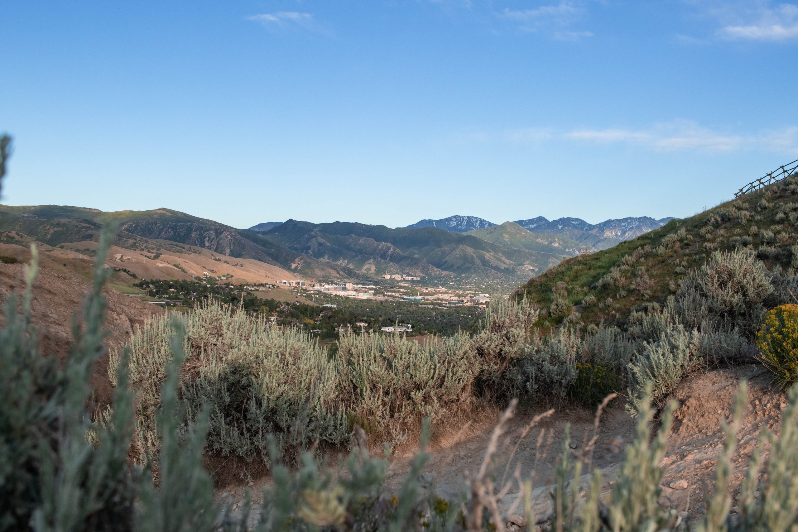
Ensign Peak
Perhaps one of the easiest hikes in Salt Lake, Ensign Peak is located north of the city and is an easy 0.8 out-and-back trail with an elevation gain of 374 feet, according to AllTrails. It features a steep climb and a short walk along a ridge before a breathtaking view of the Salt Lake basin. On a clear day, you can see far and wide! Dogs are allowed on this trail, but must be kept on-leash at all times.
If you’re looking for more of a hike, take the 0.5 mile one-way trail to the Bonneville Shoreline Trail and traverse this easy, up and down trail for as long as you like. Sunsets up here are certainly breathtaking, but can be windy on the exposed trail. Make sure to bring an extra layer – once the sun goes down, it will get chilly!
Bonneville Shoreline Trail
Mentioned in the previous trail, the Bonneville Shoreline Trail, or BST for short, is an extensive trail that runs all the way from Logan to Provo. It’s a beauty of a trail and certainly is accessible to all! There’s multiple access points ranging from trailheads right near I-80 all the way to northern Salt Lake and down by Draper.
One of the very best access points is at Orson Smith Park in Draper. A short, steep climb up to the trail yields minimal crowds and two gorgeous walks in opposite directions. Stay to “hiker’s left” once you’ve gotten to the top, and traverse your way across a beautiful suspension bridge into some thicker trees and cool rocks! Stay to “hiker’s right” and you can get clear views of the setting sun over the Salt Lake valley and beautiful views of the rest of the city. It’s quite the spectacle!
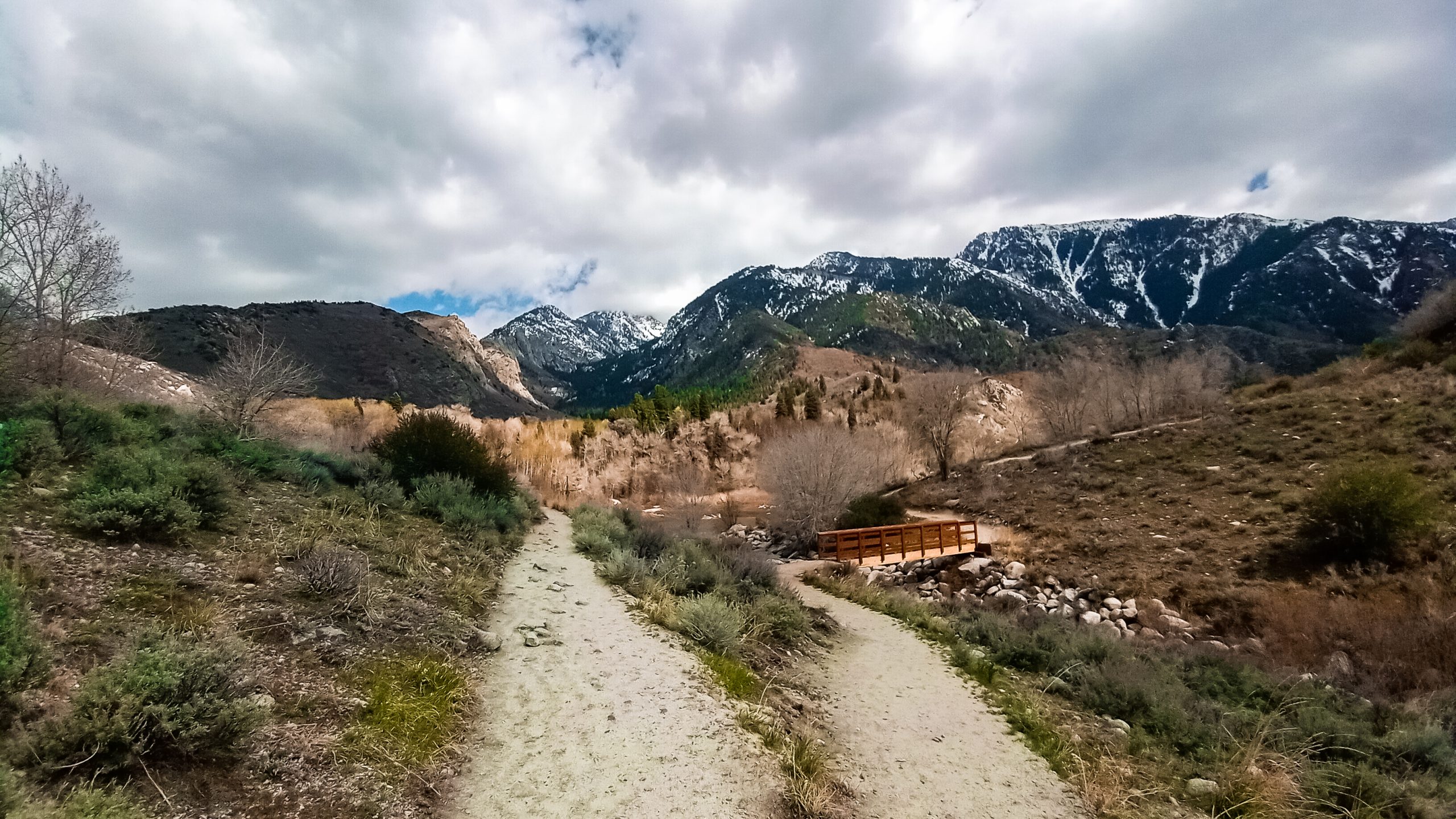
Pipeline Overlook Trail in Millcreek Canyon
A half mile up Millcreek Canyon sits trail access to the Pipeline Overlook trail, a 3.2 mile round trip out-and-back route with beautiful views over Salt Lake City. It’s also called the Rattlesnake Gulch Trail, so keep that in mind!
Starting off with a steep, 0.6 climb to a rim trail, it can be challenging at the beginning but is rewarding once you’ve reached the rim! From there, it snakes back out of Millcreek Canyon until you’re rewarded with the awesome view!
Spring is a great time to check this trail off the list; there’s not much shade on the rim portion of the trail, and even though it’s only 3.2 miles, it will get very hot! It’s never a bad idea to carry water with you, even in spring time. Be sure to check Millcreek canyon ahead of time – mountain biking season is beginning, and there may be a few run-ins with bikers on crossroads of this trail! Dogs are allowed off-leash in Millcreek Canyon on odd-numbered days, and mountain bikers are allowed on the trails on even numbered days. Plan accordingly!
Tunnel Springs Park
Up north of the city is a small trail system based out of Tunnel Springs Park. It has flowing green grasses in summer time and is an all-around, easy hike for the whole family. There’s no reason to out mileage on this trail – you can go for as short or long as you like! There are several trails which break off of the main trail and seemingly countless overlooks. Nearly the whole time, you’ll have splendid views of the Salt Lake basin and the Wasatch Mountains if you walk for at least 2 miles one-way.
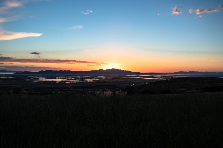
This is a popular popular photographer destination in summer. This place is a popular location for photographers and portrait sessions. Do this one in spring to avoid the crowds! There is also no shade on the trail – best to hit the trail in the evening for lower temperatures, and killer views of the sunset nearly the entire duration of the trail.
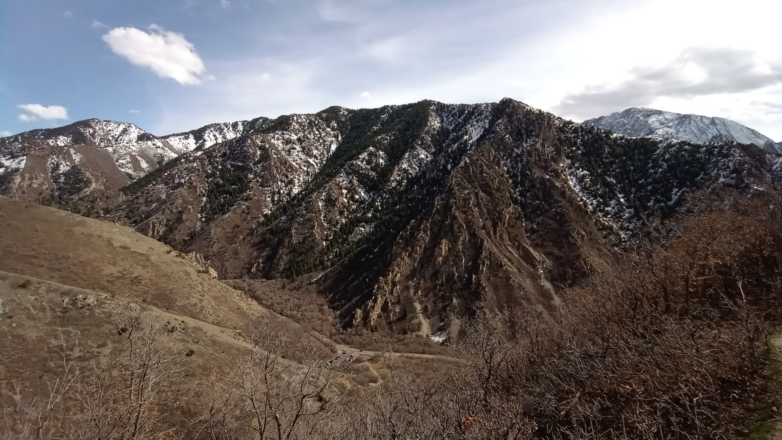
Grandeur Peak Trail – West Approach
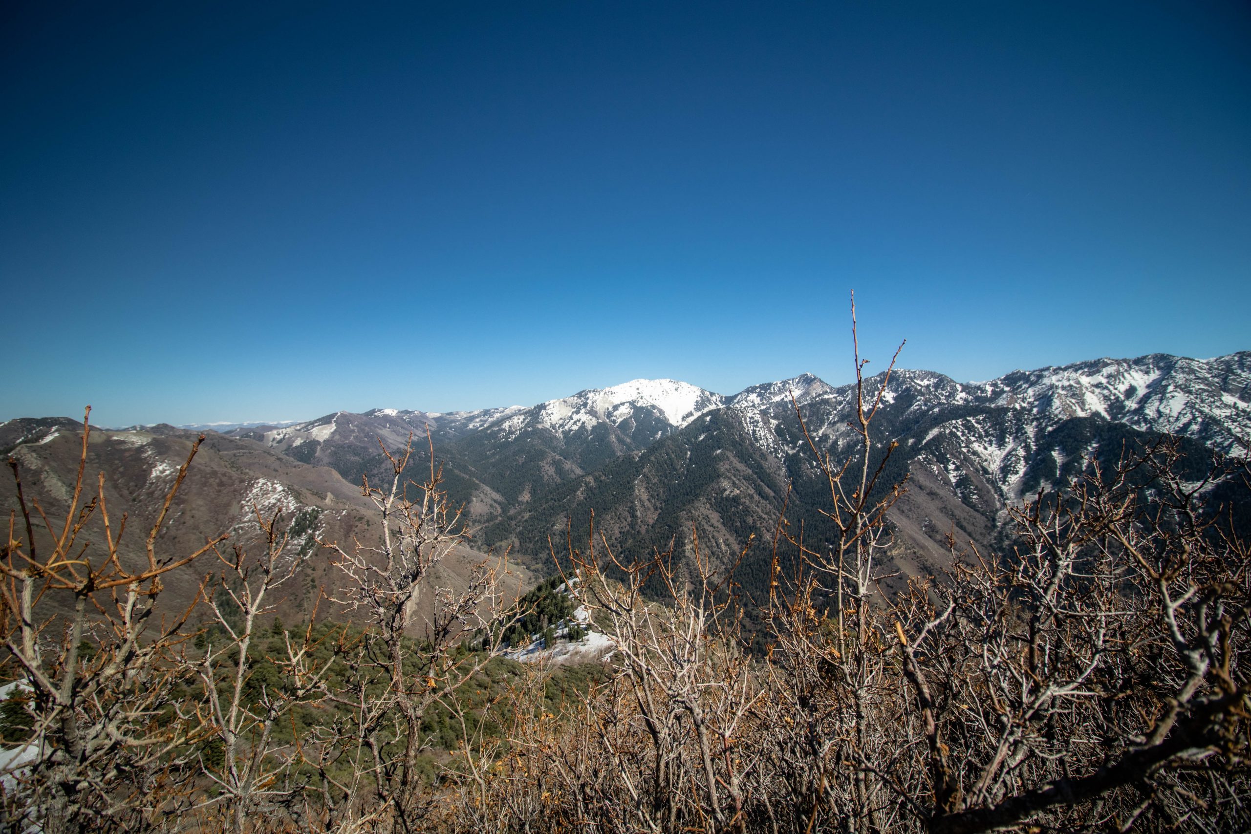
This approach to Grandeur Peak is a 4.4 mile round trip hike to the summit of the peak with a total elevation gain of 3,238 feet. It’s a steep, hard hike and should be attempted by those who wish for a longer, harder hike!. At the top, you’ll be greeted with spectacular views of Millcreek Canyon as well as Salt Lake. If you’re lucky you’ll still get some fantastic views of snow-covered peaks across the canyon and no snow at the top. According to some recent hiker reports from AllTrails, there was snow at the top as recently as March 18, 2021:
“Only the top 1/5 is covered in snow and spikes were helpful. The rest of the trail was mostly dry with occasional mud and some loose rocks.”
This trail may be best attempted in mid-April or early May to let the snow melt off and the trail dry a little more, but, you have been warned! See the full report of the west approach here.
This trail does have an east approach, but snow along the trail may make this approach more difficult. Wait until late spring or early summer before doing this approach for the trail to dry out. There’s also the option of doing Grandeur Peak as a point to point hike, or thru-hike. Park a car at each starting point (Church Fork for inside Millcreek Canyon), and the other at the end of Wasatch Boulevard.
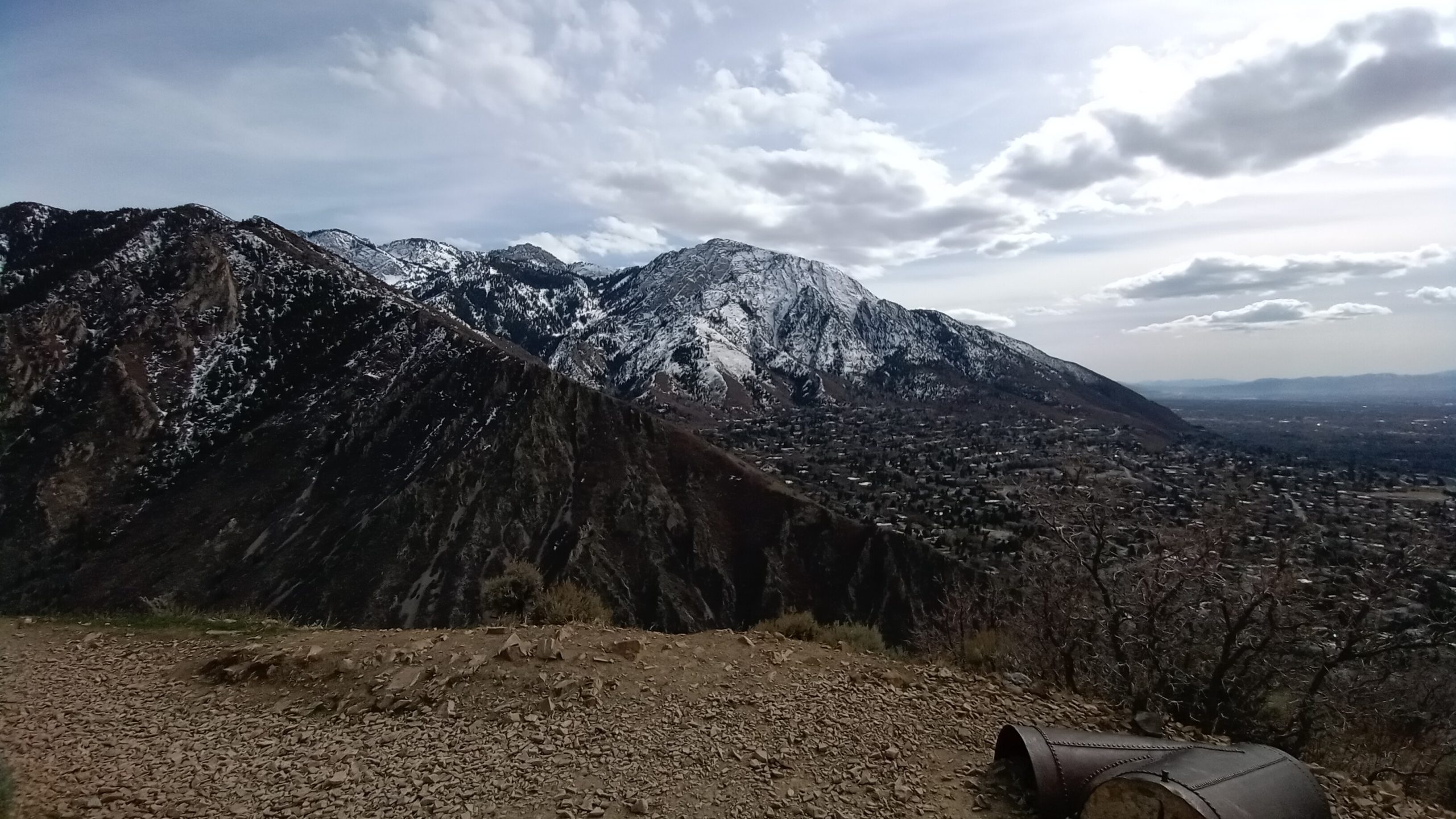
Grandeur Peak Trail – North East Approach
This trail might be one of the best trails in Millcreek Canyon! You approach from the north and east, and the trail is fairly difficult. AllTrails clocks this hike at 5.6 miles, 2365 ft elevation gain, but after completing the trail and tracking it, the trail is closer to 7.0 miles with 2,562 ft elevation gain. However, despite this, it is totally worth the long trek! Take about 3 hours to complete this hike so you can take time to appreciate the beautiful views throughout the hike!
Start out at Churck Fork, and traverse though a picnicking area before reaching the trailhead. You’ll travel by a stream for a little ways, until you reach a fork in the trail; bear right to keep on heading towards Grandeur Peak! Make sure to keep your head up, views will be great as soon as you break through the tree line! And, once you get to the top, the views are quite unbeatable!
Crestwood Gulch Trail Loop
The Crestwood Gulch Trail Loop is a 5.1 trail with 1,666 elevation gain and is rated as difficult. There should be no snow on this trail, as the approach is from the west. After small spring storms, some snow may be present, so watch the weather when planning this hike.
In spring, this trail is filled with flowers of all sorts, so it may be more worth it to wait on this trail until early May! To see more trail info, check out the AllTrails entry right here.
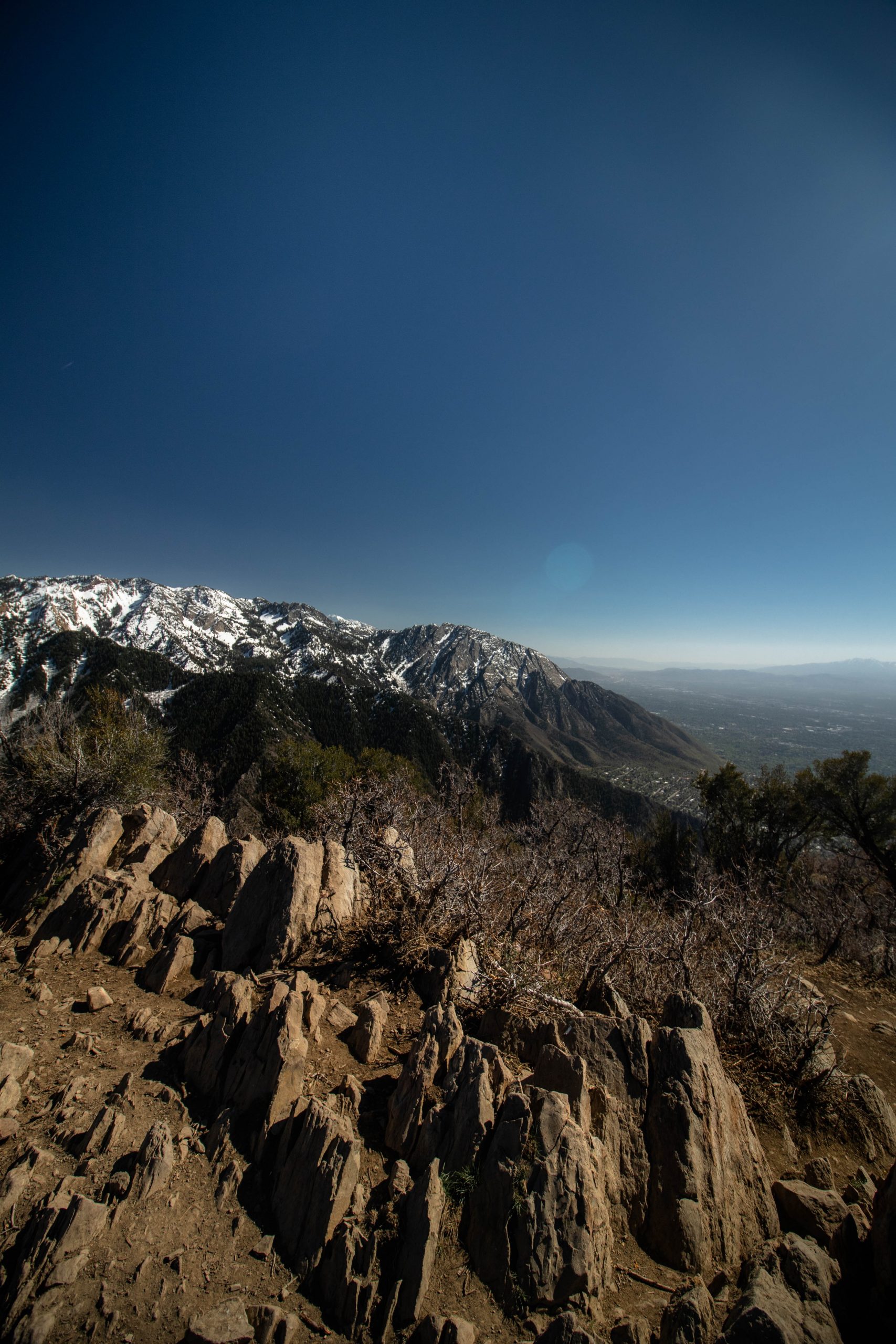
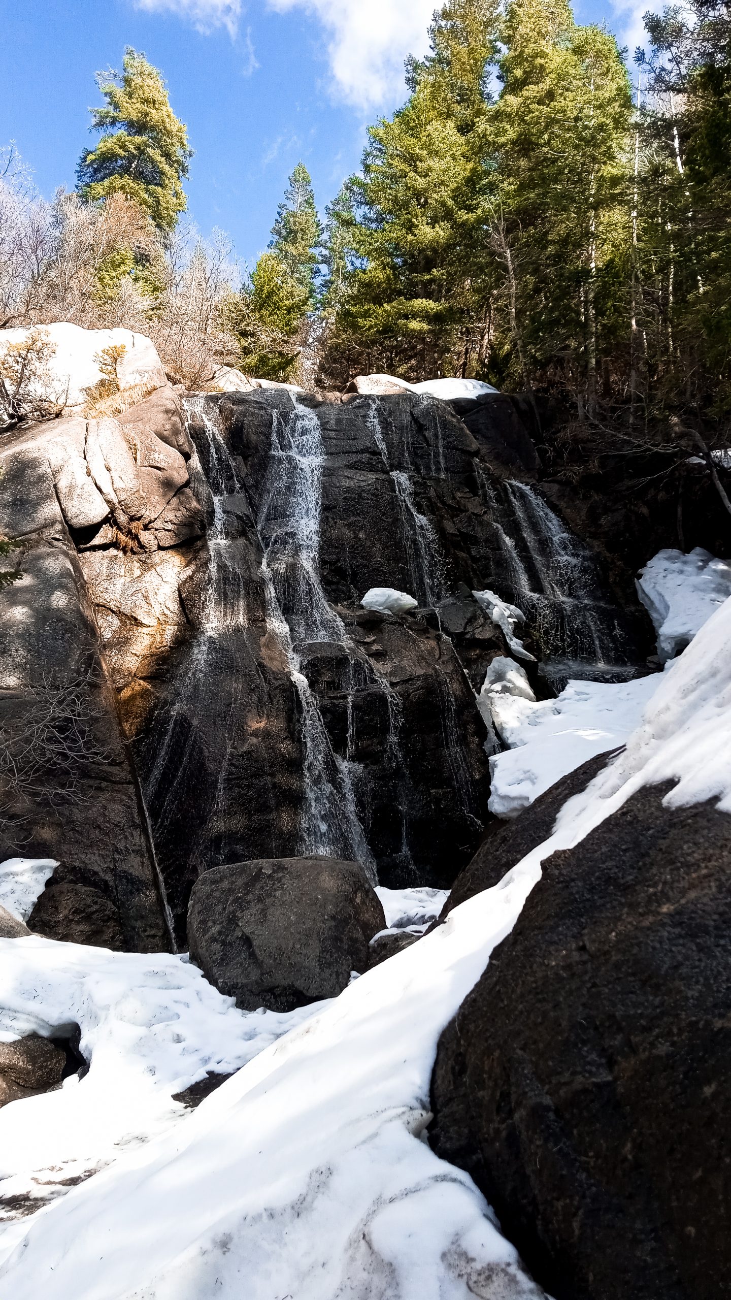
Bells Canyon Lower Falls
Bells Canyon to Lower Falls is a 4.6 mile roundtrip hike with a total elevation change of 1,453 feet. It’s an out and back route located just outside of Little Cottonwood Canyon. There are two trailhead access points to this hike – one Wasatch Boulevard, and the other on Little Cottonwood Canyon Road. Park at either of these entry points – one or the other may be full, so prepare a backup plan!
This trail hikes up pretty steeply in the beginning, where you reach the Lower Reservoir. It’s quite beautiful in spring, as the reservoir is usually quite full, and resembles a small pond. From there, you walk a little futher, and bear left at a sign that says ‘waterfall’. Follow this trail as it snakes up to the waterfall! It can get quite steep, so be prepared for a stair-master ascent! In April you may encounter some snow near the top – be prepared to go slowly! In May, you’ll encounter wet spots near the top, but nothing a good pair of hiking boots can’t handle.
That’s all for now! We will update this blog with more dry hikes as the weather gets warmer and we find more stunning trails! Be sure to stay tuned for some trails in Park City for summer!
If you attempt any of these, let us know in the comments how it was and which trail you did! We could love to connect with you on our mutual love of The Great Outdoors and these beautiful hikes.
